FROM WHAT?
The Truth About SaveParleys.org
THEY SAY
"THE COMMUNITY HAS SPOKEN"
But did the "community" have the facts? Watch THEIR video (saveparleys.org) to see their FAKE version of Parley's Canyon
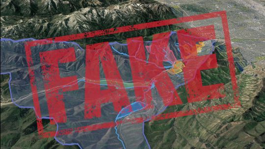
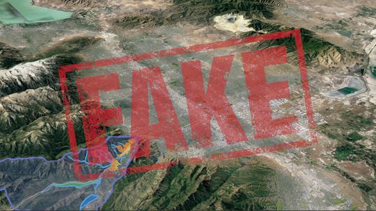
This visual is an example. Everything about it is deceptive.
- Protected watershed STOPS above the quarry site
- NO drinking water is affected by the quarry
- The area in red is NOT the mine site
- Was never zoned “Forest/Recreation” before 2 years ago.
- The yellow and orange show PRIVATE land in Lower Parley’s
- NO ONE is talking about mining all that land – FAKE
- Comparison to Kennecott is ridiculous
- Net new impact on air quality in SL valley will be ZERO
Now watch OUR video, responding to the opposition’s propaganda. Get the TRUTH about what Parley’s Canyon is…and isn’t
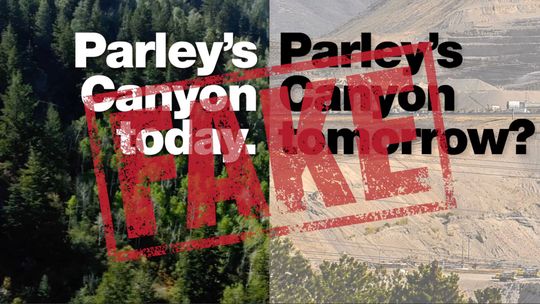
Why Lie?
Let's start with this rendering. THEY say this is what will become of Parley's if the quarry is allowed.
The problem? It is a complete fake. The overall parcel of land is 634 acres, but the proposed mine is only 20 acres - less than 1/30th of what THEY say.
If the proposed quarry is so bad, why do they have to make things up?
Why can't they just tell the truth?
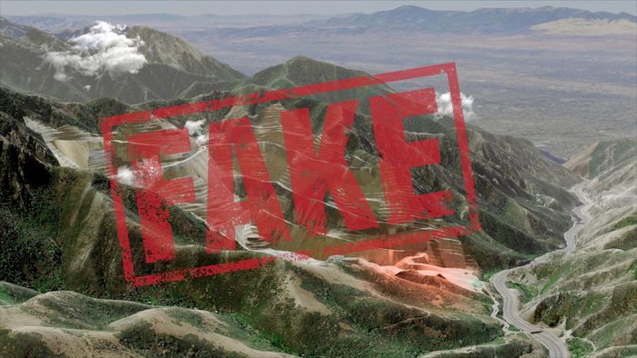
More truth about Parley's
- Lower Parley's IS an active, busy canyon with lots of human activity.
- Lower Parley's is NOT “pristine” – it is the right-of-way for a major Interstate Freeway carrying over 60,000 vehicles daily.
- Lower Parley's is NOT a recreation “Mecca” – it’s private land- there’s NO public land access, NO fishing waters, NO bike or hiking trails.
- Lower Parley's IS a historic district – a historic MINING district, since before statehood.
- Lower Parley's is NOT PROTECTED WATERSHED - that protection ENDS AT THE DAM, before the proposed quarry site.
- Lower Parley's Creek IS contaminated – but not from rocks. Somebody really ought to look into where that SEWAGE CONTAMINATION comes from…
FROM WHAT?